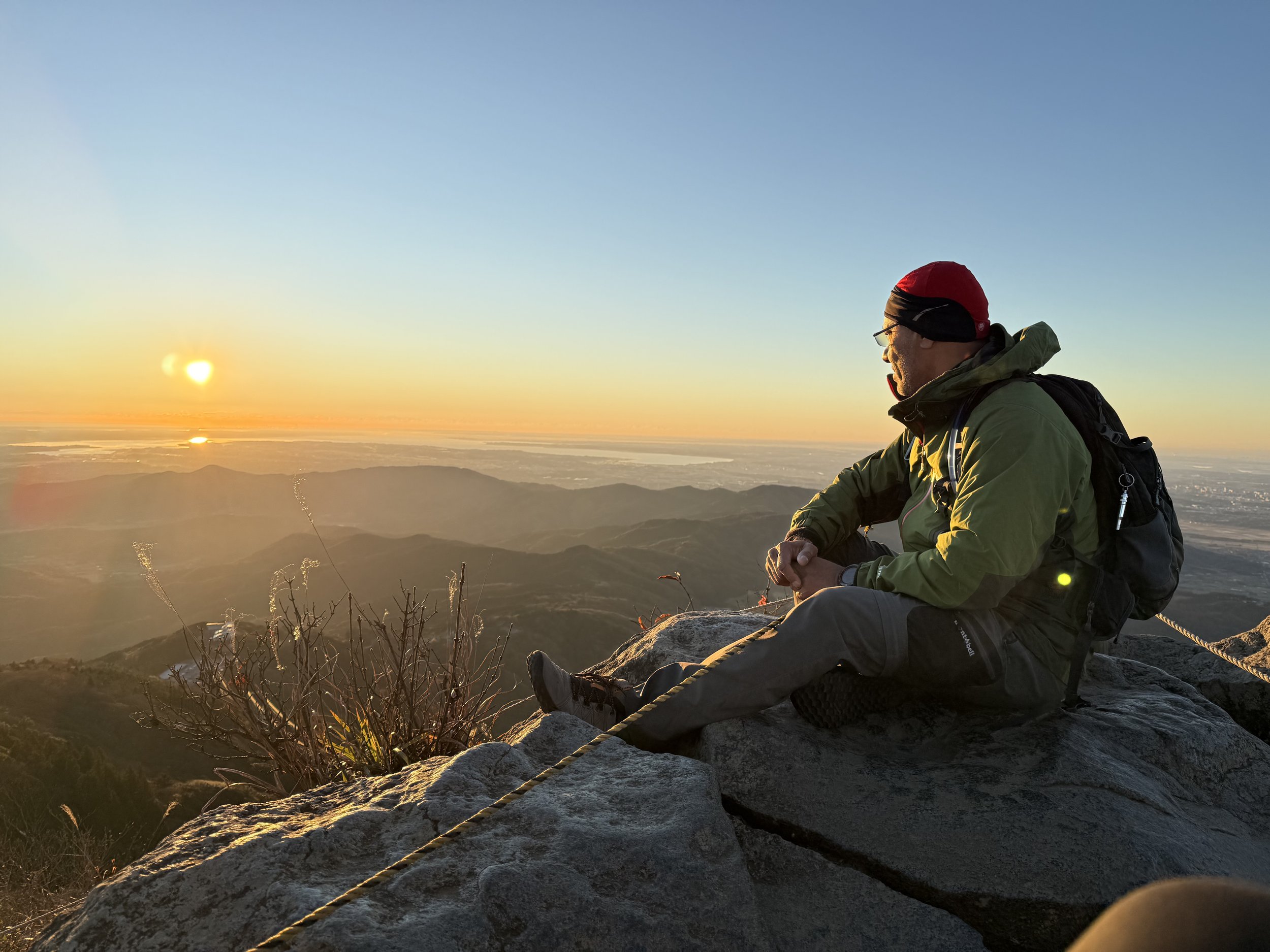
ADHD changed our lives—but not in the way you might expect. Diagnosed early, our son Haruki has thrived. I, on the other hand, was undiagnosed for most of my life. Living with ADHD has been its own constant battle, impacting every part of my life in ways I’m still learning to understand. But I made a choice - I emptied my short comings and invites physical and mental challenges of hiking 100 Famous mountains of Japan, to confront my demons head-on. Every summit I reach is a step toward understanding and managing my ADHD. This page is about more than mountains. It’s about struggle, resilience, and the messy, honest path to reclaiming my life and helping my son how to live with ADHD. I’m sharing it all—the setbacks, the victories, and the lessons along the way.
Region: Shizuoka-ken
Elevation: 1,406m (4,613 ft)
Coordinates: 34°51′46″N 139°00′06″E
Trailhead: 天城縦走登山口 (Amagi-juusou-tozanguchi )
-
Amagi Mountain Range (天城連山), stretches east to west in the central Izu Peninsula, highest point in the Izu Peninsula. Mt Amagi range has three peaks - Mt. Banzaburo (万三郎岳) at 1,406m (4,613ft), and Mt. Banjiro (万二郎岳) at 1,300m (4,300 ft) and Tōgasayama (遠笠山) at 1,197m (3,927 ft).
Like most of the trails in Japan, there are signs marking the trail - you just can’t get lost. Then again, if you follow signs, you are following someone else’s path - this is my problem (I was told so million times…). So, just to live up to my “reputation”, I took many alternative paths (this, I don’t recommend, unless you are willing to spent 12 hrs. instead of 8).
Region: Saitama, Yamanashi Prefecture
Elevation: 2,017m (6,617 ft)
Coordinates: 35°51′19″N 138°56′37″E
Trailhead: 小袖登山口 (Kosode)
-
The summit is the highest point in Tokyo is known as "cloud grabber mountain". Located within the Chichibu-Tama-Kai National Park at the border of Tokyo, Saitama, and Yamanashi prefectures. Is one of the Japan’s 100 most famous mountains, Mt. Kumotori is easily accessed from central Tokyo. The hiking network stretch over 20KMs with many courses available. Most of them take considerable amount of time so it is common for lodging for the night. I wanted to finish the hike in a day, so I took the shortest distance up the summit and back from Kamosawa trailhead near Lake Okutama (Okutama-ko). From the parking area, I walked few minutes and the entrance to the trail on the left. I continue hiking up through the path. For first couple of KMs the path was pretty easy with tiny bit of snow patches but as I continue upward, there was a quite bit of snow. Snow was not an issue, but frozen ice patches was very slippery. At about 5 KM mark, I arrived at Dodokoro. From here, the trail runs along a ridgeline. Then I reached the fork at Mamushi-iwa Rock, here the path split into two – I continued in the direction of Nanatsuishi-goya mountain hut. Hiking up through a steep patch with somewhat frozen and slippery snow was to reach the Nanatsuishi-goya bit challenging – I took my time. It was so quiet and peaceful. There is a small store at the mountain hut and also a pay toilet. I took a short rest and continue hiking up the trail past the nearby shrine and entered the trail on Ishi-one ridge. After about 4 hours of hiking l arrived at Mt. Nanatsuishi (Nanatsuishi-yama). It was cold and started to snow - I started to worry about timing. I did not spend more than few minutes and head back. Hiking down in slippery snow was not fun but at the same time it was great experience
Region: Kanto, Nigata Prefecture
Elevation: 1,977 m (6,486 ft)
Coordinates: 36°50′14″N 138°55′47″E
Trailhead:
-
Mt Tanigawa (谷川岳) is a 1,977M a towering and beautiful symbol of the north. Is located on the border of Gunma Prefecture and Niigata Prefecture. Known as the "Mountain of Death," with a tragic history, claiming over 800 lives over the years, primarily due to rock climbing and challenging conditions.
Elevation: 1,954.7 m (6,413 ft)
Coordinates: 33°51′13″N 134°05′39″E
Trailhead: Minokoshi
-
Mount Tsurugi (meaning sword), is a mountain on the border of Miyoshi, Mima and Naka in Tokushima Prefecture, Japan. This mountain is one of the 100 Famous Japanese Mountains and is the second highest mountain in western Japan. Mount Tsurugi (剣山) is an important object of worship in this region and one of the centers of Shugendō, a sect of mixture of Shinto and Buddhism. On the top of the mountain, there is a small shrine called ‘Tsurugi Jinja’. Supposedly, on a clear day the view from the summit reaches out to the Pacific Ocean, the Seto Inland Sea, the Kii Peninsula and Okayama Prefecture on mainland Japan. However, it was raining and cloudy.
After riding 1100+km over 9 days in blistering heat around Shikoku Island, I figured I might as well hike at least one of the “100 famous mountains in Japan” to top up my list to 9 (91 to go). Even though, I knew cycling and hiking muscle are different, I led myself to believe that I would be fit to climb all the way from the bottom (Minokoshi) instead of taking "climber's lift" to a trail high in the mountains. I was wrong – dead wrong. In than 500M to the climb, I started feeling the pain – almost like I’ve forgotten to hike, forgotten to put one leg ahead of another. By the time I reached to the trailhead, I’ve already climbed 1400M and my muscle memory seems to have figured what needs to be done to take me up to the 1955M peak.
In addition to Mt Tsurugi (highest peak), there are two other peaks – Mt Ichinomori and Mt Jirogyu. It took me nearly 6 hours to complete all 3 peaks. I was NOT going to climb down to I took the chairlift down. I was thinking to climb Mt Ishizuchi, so I can top up my “100 Famous Japanese Mountains”. But mother nature had other plans – heavy rain forecasted the next day. So I decided to head back to Kobe
Region: Okuchichibu, Saitama Prefecture
Elevation: 1,723m (5,563ft)
Coordinates: 36°13.31′N 140°06.24′E
Trailhead: 日向大谷口登山口 (Hinata-Ōya-Guchi)
-
Located in northern border of the Chichibu Tama Kai National Park in the Saitama Prefecture is a sacred mountain. It was toughest climbs and was a difficult challenge (at least for me) with steep rock walls, saw-toothed ridges, and chain sections.
Mt Ryokami (両神山) is a sacred mountain located in northern border of the Chichibu Tama Kai National Park in the Saitama Prefecture. It was tough climb with steep rock walls, saw-toothed ridges, and chain sections and was a difficult challenge (at least for me). Despite that saying that "it's not the top of the mountain, but the journey"? I enjoyed the exposed, rocky summit with 360-degree panoramic view.
Region: Kanto, Yamanashi Prefecture
Elevation: 2,057 m (6,749 ft)
Coordinates: 35.7487°N 138.8455°E
Trailhead: 大菩薩峠登山口 (Daibosatsu-touge)
-
Mt Daibosatsu (大菩薩嶺) is in the Yamanashi side of Chichibu Tama Kai National Park. It is 2,057M high. Daibosatsu Pass divides Kōshū from Kosuge Village. From the Southern Alps from the summit, you can see Mt.Fuji. There are two trailheads, Kamihikawa-Tōge and Daibosatsu-Toge Tozanguchi – both can be access by public transit and both has parking (I hiked both - one by myself and other with Haruki). Both trails are easy to walk.
Region: Okuchichibu, Yamanshi Prefecture
Elevation: 2,230m (8,527 ft)
Coordinates: 36°50′14″N 138°55′47″E
Trailhead:
-
Located between Tokyo and Nagano in region there are many hiking trails as well as rock climbing. The trailhead is for both Mt. Kinpu and Mt. Mizugaki (two peaks next to each other). Mt. Mizugaki is shorter distance but with higher attitude whereas Mt. Kinpu is longer distance with moderate attitude.
There is a parking at the trailhead with toilet facilities. After about 15 min hike, you will come across area where there is tent area (I believe it’s called Mizugaki Sanso Hut). That is where the hike split to Mt. Kinpu and/or Mt. Mizugaki. Youll need to take left path towards Mt. Mizugaki. After a slope, incline gradually increases. It takes about 3 hours to reach the top. I think this hike fits for hikers of all skill levels. The terrain here includes some scrambling and the odd chain, but nothing too technical. There is no water up here, so bring enough water.
Region: Kanto, Nigata Prefecture
Elevation: 877 m (2,877 ft)
Coordinates: 36°13.31′N 140°06.24′E
Trailhead: 筑波山神社 (Tsukubasan-jinja Shrine)
-
Also known as “Purple Mountain” is double peak - Nyotai-san (女体山) and Nantai-san (男体山). mountain located towards the north of Tsukuba city with panoramic view of Kanto region. This is the lowest mountain out of 100 famous mountains of Japan. In my view, it doesn’t feel like climbing, more like hiking.
Region: Okuchichibu, Saitama Prefecture
Elevation:1,723m (5,563ft)
Coordinates: 36°13.31′N 140°06.24′E
Trailhead: 日向大谷口(Hinataooyaguchi)
-
Is one of the mountains of the Tanzama Mountains range (group of peaks located on the south side of Kanagawa prefecture), with an elevation of 1,567M (5,141 ft). Its summit marks the border between Sagamihara, Kiyokawa in Aiko and Yamakita in Ashigarakami in Ashigarakami.
Region: Kansai region, Honshū
Elevation: 1,719 m (5,640 ft)
Coordinates: 34°15′10″N 135°56′26″E
Trailhead:
-
Mount Ōmine, officially known as Mount Sanjō is a sacred mountain famous for its three tests of courage, located in Ōmine mountain range in Yoshino-Kumano National Park in the Kansai region, in Nara, Japan. Stands as a testament to Japan's rich spiritual heritage is a cornerstone of Japanese Buddhism and Shugendo practices for over 1,300 years. Mount Ōmine was designated by UNESCO World Heritage Site as part of the "Sacred Sites and Pilgrimage Routes in the Kii Mountain Range”.
At the base of the mountain, a prominent sign reads "No Women Admitted," and a stone pillar marks the boundary beyond which women are not permitted. Essentially some areas are prohibited to women.
Mount Omine is renowned for its three "tests of courage”:
a) Kanekake Iwa - This involves climbing a 30-foot cliff face, with the final section requiring climbers to swing out over an overhang using an embedded chain. The physical and mental challenge of this test is seen as a way to overcome fear and demonstrate commitment to spiritual growth.
b) Nishi no Nozoki – This involves Participants are held head-first over a 60-meter high cliff, where they are compelled to admit their faults and promise to follow social and religious laws. This practice is believed to induce a profound spiritual experience through confronting one's mortality.
c) Byodo Iwa - involves traversing a rock tower that overlooks a deep cliff, using projections from the wall to cross from one side to the other. This test symbolizes the balance and equality of all beings, as everyone faces the same daunting task regardless of status or background.