For years, I was trapped in heavy drinking and smoking. On top of that, living with ADHD has been its own constant battle, impacting every part of my life in ways I’m still learning to understand. But I made a choice: to confront my demons head-on. Now, I’m taking on a new challenge—climbing Japan’s 100 Famous Mountains. Every summit I reach is a step away from addiction and a step toward understanding and managing my ADHD. This page is about more than mountains. It’s about struggle, resilience, and the messy, honest path to reclaiming my life. I’m sharing it all—the setbacks, the victories, and the lessons along the way.
If you’re fighting your own battles, whether it’s addiction, ADHD, or both, I hope this journey reminds you that change is possible. Let’s climb.
The 2,057-meter Mount Daibosatsu (大菩薩嶺) is one of the “100 Famous Mountains” of Japan. Located in Chichibu-Tama-Kai National Park, on the border between Yamanashi, Nagano, Saitama, and Tokyo. There are few courses – I choose course starts Kamihigawa pass (high-elevation trailhead is at1580M). Hike is relatively easy – it took us around 5 hours (including lunch). No truly hazardous sections so good for beginners and children.
Mt. Tonodake (also known as Mount Tō / 搭 ノ 岳) is in the Tanzawa mountain range runs about 40 kilometers east-west through northwestern Kanagawa Prefecture. There are number of mountains in Tanzawa range and two are in the list of “100 Famous Japanese Mountains”. Both can be hiked in a same trail and Mt. Tonodake (Tohno-dake) is the highest peak. From the Okura bus stop (also visitor center with parking lot), it is about 200-300M walk along the road to the trail head. I let the distance fooled me – I was physically and more importantly, mentally was not up to the steep and physically demanding climb waiting for me with less than couple of hundred meters.
Also known as “Purple Mountain” is double peak - Nyotai-san (女体山) and Nantai-san (男体山). mountain located towards the north of Tsukuba city with panoramic view of Kanto region. This is the lowest mountain out of 100 famous mountains of Japan. In my view, it doesn’t feel like climbing, more like hiking.
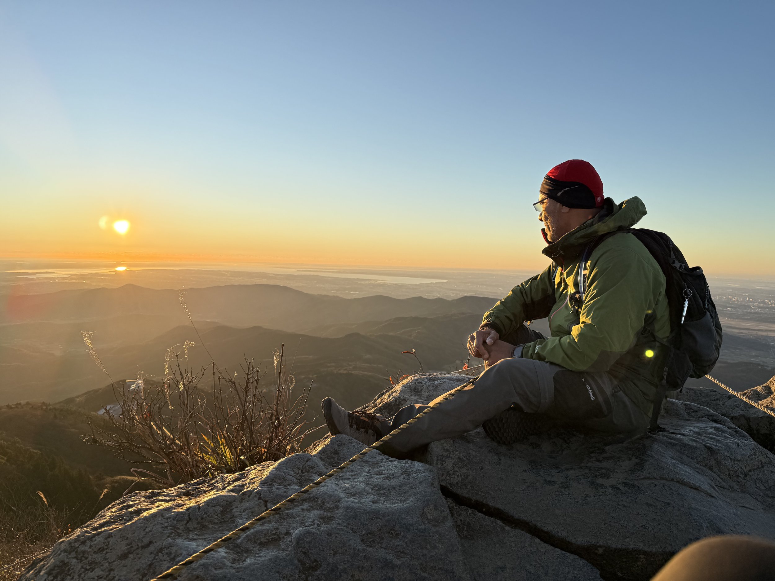
Located in Mikuni Mountain range on the border of Gunma and Nigata prefecture. The summit has twin peaks Tomanomimi (トマノ耳) and Okinomimi (オキノ耳). Now I know why it is called “Mountain of Evil”. It’s not because the handful of steep cliffs and rocky sections, it’s not because of multiple sections with chains and ladders to help you on the narrow ridge line, is not the elevation (1977M), and not the bells along the trail to scare the bears – it is sudden and unpredictable change of weather that claimed over 800 lives.
The 2,057-meter Mount Daibosatsu (大菩薩嶺) is one of the “100 Famous Mountains” of Japan. Located in Chichibu-Tama-Kai National Park, on the border between Yamanashi, Nagano, Saitama, and Tokyo. There are few courses – I choose course starts Kamihigawa pass (high-elevation trailhead is at1580M). Hike is relatively easy – it took us around 5 hours (including lunch). No truly hazardous sections so good for beginners and children.
Mt Kumatori (雲取山) is known as "cloud grabber mountain," is the highest point in Tokyo, located at the boundary of Tokyo, Saitama, and Yamanashi prefectures on the island of Honshū, with an elevation of 2,017 meters. The hiking network stretch over 20KMs. Supposedly considered a challenging route, but it wasn’t hard for me (and I am not that experienced climber). It took me around 8hrs complete (and I had few short breaks). Since this is closer to Tokyo, is a very popular area for backpacking, camping, and hiking, so I’ve encountered many people while hiking.
Mt. Amagi (天城山)
Mt. Amagi (天城山), stretches east to west in the central Izu Peninsula, highest point in the Izu Peninsula is one of Japan's 100 most famous mountains. Like most of the trails in Japan, there are signs marking the trail - you just can’t get lost. Then again, if you follow signs, you are following someone else’s path - this is my problem (I was told so)! So, I took many alternative paths (this, I don’t recommend, unless you are willing to spent 11 hrs. instead of 8). Mt Amagi range has two peaks (I call it twin-peak) Mt. Banzaburo (万三郎岳) and Mt. Banjiro (万二郎岳). I am no experienced hiker, but this is pretty straight forward easy hike.